
Marine toolbox
Biodiversity screening
What is the problem?
Effective project screening is essential to assess impacts on marine biodiversity and to inform potential mitigation strategies at an early stage in a project development life-cycle.
The ability to understand potential development impacts on marine biodiversity values depends critically on the extent of baseline understanding across multiple spatial extents. The more information that is available, the more likely that a robust assessment using an appropriate scale of analysis will be achieved. Screening studies are most often informed by desk-top studies, expert consultation, initial stakeholder engagement and field reconnaissance (FFI, 2017). However, in many places there is a lack of information available for understanding marine biodiversity baselines to inform screening studies. This provides uncertainty with respect to defining some risks to biodiversity values and how these should be mitigated. Data gaps are widespread in many developing countries; and in areas where there is little information there is potential for features of high biodiversity value to be present. Data is also scarce for some species meaning there is limited information on their presence and functions. The dynamic and interconnected nature of the marine environment also means that baseline understanding is often needed over large areas, which only exacerbates the data gaps. In some instances, due to data gaps, there can be improper bias about where development should occur due to misinterpretations that may arise when presence is assumed only for areas where data exist and incorrectly categorising ‘no data’ areas as ‘low biodiversity value’ areas. Therefore, caution needs to be applied when interpreting existing data.
Baseline gaps can be addressed through the collection of primary data. Primary data collection is not often taken forward at the screening stage due to several factors, including for example, alternative site analysis across broad seascape areas, insufficient certainty on project viability, budget allocation and the time that is made available for screening studies in the project development life-cycle. Indeed, the outcomes of screening studies are often used to inform the type of field surveys that may be required as part of subsequent assessment phases. Whilst primary data collection could potentially address gaps in knowledge significant uncertainty may still emerge in some data poor regions, i.e., where key species exhibit spatially and temporally complex distributions, and where surveying is hampered by environmental conditions, such as light, depth, ice cover. Also, the behaviour of some species can make field surveys difficult, costly and time consuming to deliver. Finally, it may not be feasible at a project-level to conduct field surveys across seascape areas and a broad-scale understanding is often needed, especially for wide-ranging species.
Screening approaches usually consider risk, but actions to manage these risks across the mitigation hierarchy may not be considered in detail at this stage. This can be due to limited project information or baseline data being available. It may also be due to a stepped approach in undertaking assessments, with mitigation only considered once specific project details are available and a more detailed assessment of impacts has been completed.
Why is it a problem?
A lack of data and uncertainty can undermine the understanding of baseline conditions, which can lead to projects proceeding without fully knowing the potential risks they may pose for marine biodiversity. This can cause problems for screening risks to marine biodiversity at a time when important decisions are made on where a development will be located and how facilities will be constructed and operated.
Not understanding the potential biodiversity mitigation measures that may be required at an early stage may mean that developers may not fully understand the consequence of decisions being made. Also, often there is limited understanding of uncertainties associated with the effectiveness of mitigation measures. This may result in an over-reliance on later steps in the mitigation hierarchy where avoidance is not embedded into project decision-making at an early project stage. The adoption of early avoidance approaches supported by effective screening is often critical to address risks to marine biodiversity and to manage business risks during project execution (e.g., for permitting, access to funding, time, cost, reputation, and alignment with corporate nature positive goals). For instance, if there is a reliance restoration and offsets it may be difficult to quantify losses and to deliver approaches that balance these in a way that ensures no net loss or net gains.
What are the solutions?
A project will need to incorporate robust and transparent techniques to provide marine biodiversity baseline understanding, including approaches to evaluate and address uncertainties.
Good practices for biodiversity baseline studies can be found with reference to the ‘Good Practices for the Collection of Biodiversity Baseline Data’ (Gullison et al., 2015). Whilst this guidance document is not focused on approaches for the screening stage and does not specifically relate to marine biodiversity, it provides information that may support screening studies, including:
- how to define study areas
- the completion of scoping baseline studies, desk-top assessments (including the review of scientific literature and global datasets), field reconnaissance and field surveys
- the need for early primary data collection where multiple field surveys are required to provide adequate baseline understanding
- the importance of early consultation with stakeholders to help identify biodiversity values
- the value of local ecological knowledge
- how baseline studies can support the application of the mitigation hierarchy
Another useful guidance document that provides information to support screening studies is the ‘Good Practice Guidance for Oil and Gas Operations in Marine Environments’ (FFI, 2017). Whilst this document is focused on one specific sector it provides information that can be generalised for the screening of many types of development in the marine environment. Of note, this document provides specific guidance for studies that can be completed at the screening stage, including information on the use of existing databases and the importance of stakeholder and expert engagement. It also provides guidance on delineating baseline study areas.
Further guidance can be found in the Bluedot document ‘Guidance for Defining Ecologically Appropriate Scales of Analysis for Marine Biodiversity in Relation to IFC Performance Standard 6’ (Cousins and Pittman, 2021). This provides guidance on how to define appropriate baseline study areas that are specific to marine biodiversity, which can be used to guide how screening assessments are completed. This includes highlighting the importance of seascape assessments to provide an understanding of marine biodiversity values.
As previously stated, projects should include approaches for primary data collection as soon as possible. Primary data collection would ideally inform screening studies, but as previously mentioned, at this stage, this is not always taken forward as a standard approach or may not be possible. To support screening studies, the collection of primary data requires projects to focus early on identifying critical long-lead and priority issues; and to start to collect data as soon as possible in a project development life-cycle. It may be appropriate for primary data collection to support screening studies where extensive data gaps are evident that cannot be addressed through other approaches; and where there is potential for natural and critical habitat to be present, a predictable need for multi-seasonal data, and potential for impacts on legally protected and internationally recognised areas even if a site is not located within such areas. The undertaking of primary data collection is likely only feasible where there is sufficient pre-development planning and allocation of sufficient time for the project assessment phase; and the provision of budget to support the undertaking of such studies at a very early development stage. It may be appropriate for development sites where alternative locations are very limited or where a developer plans multiple projects in a seascape. It may also be possible to collaborate with and support existing studies already occurring within seascapes and/ or to promote joined-up approaches across different developer projects within the same seascape. Strategic and collaborative data collection approaches may reduce the onus for individual projects and lead to better information being available to inform project-level screening. The implementation of such approaches may be best achieved through top-down approaches driven through, for example, the requirements and approaches of governments or financial institutions who will permit or finance multiple projects within seascapes.
Desk-top studies normally include the review of existing literature (published and grey) and datasets, consultation with stakeholders and experts. There are many datasets available to support screening studies. The Ocean+ Library has recently been developed to collate and provide access to a range of relevant datasets.

is a meta-database that provides information on online resources and data of ocean biodiversity importance. Users can search the information on the platform to find relevant resources that support effective ocean conservation on a regional and global level.
Some go-to resources used by Bluedot to support screening studies that are included in the Ocean+ Library are shown below.
The Integrated Biodiversity Assessment Tool (IBAT)
Ocean+ Habitats
Ocean Data Viewer

The Global Biodiversity Information Facility (GBIF)
Ocean Biodiversity Information System (OBIS) and OBIS-SEAMAP
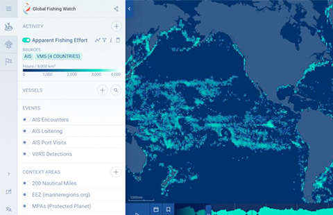
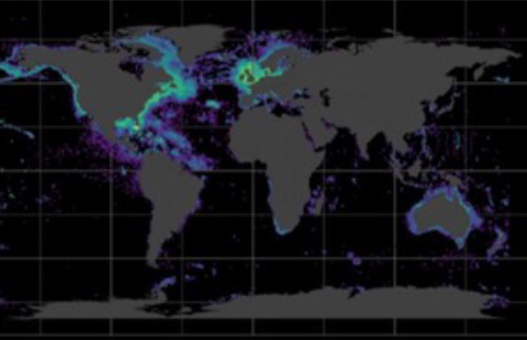
Global Fishing Watch
Seabird Tracking Database
Global distribution of Important Marine Mammal Areas

Ecologically or Biologically Significant Marine Areas
European Marine Observation and Data Network (EMODnet)

Marine Ecoregions of the World (MEOW)

IUCN Red List of Threatened Species
FishBase
SeaLifeBase
Migratory Connectivity in the Ocean (MiCO)
Other useful data sources not included in the Ocean+ Library, at this time of writing, are provided below.

UNbiodiversitylab

eBird

iNaturalist
Allen Coral Atlas

Protecting Blue Corridors

Seaturtle.org tracking data
AquaMaps
Soaring Bird Sensitivity Map Tool
SIREN and SIREN Turtle
Seagrass Spotter

IUCN Red List of Ecosystems

Ramsar Sites Information Service
BirdLife Data Zone
Important Shark and Ray Areas
It is worth noting that IBAT includes data from numerous datasets, including data from some sources shown above; and some datasets may have restrictions for commercial use (FFI, 2017).
As previously noted, even with the collection of primary data and desk-top review of all available information, uncertainties will often remain for marine biodiversity values. Cousins and Pittman (2021) provided recommendations for managing uncertainties in baseline data, which can be applied at the screening stage. This includes the use of broad-scale information across seascapes to provide precautionary and predictive understanding of values that may be impacted by projects. Approaches outlined in this guidance document include the use of:
- habitat preferences to define suitable habitat to predict species presence and distributions, including applying knowledge on spatial limits related to movements offshore, connectivity to habitats that are known to be present, extending sightings data from one area to another across seascapes etc.
- predictive mapping of biological distributions using modelling.
- spatial proxies or surrogate variables to determine habitat and species presence and distributions, e.g., bathymetry, geographic context, upwelling areas, fishing zones etc.
- local ecological knowledge (e.g., citizen science data, fisheries information etc).
- habitat- and species-specific expert judgements.
At the screening stage, it is also possible to use rapid assessment tools (remote and field-based) to provide data that allows for some initial understanding of the biodiversity values that may be present. Rapid assessment tools can also be used alone or in-combination with other approaches. They can inform the understanding of baseline at a site-level but can also enable rapid data collection over broad scales. Such approaches can also help to build in-country networks and support the participation of local people. Some tools that are used by Bluedot to support our screening studies are summarised below.
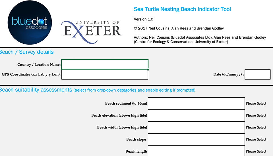
The Sea Turtle Nesting Beach Indicator Tool was developed in collaboration between Bluedot Associates and sea turtle experts within the University of Exeter. It can be used to rapidly identify habitat suitability for nesting and the level of disturbance that may affect the quality of nesting habitat.
Environmental DNA (eDNA) is a tool that can generate high-resolution marine biodiversity data. eDNA techniques allow for low cost and rapid baseline data collection. A key benefit of this approach is that data can be collected by non-scientists with minimal equipment needs. eDNA allows for big-scale data to be collected and facilitates monitoring at various spatial scales, including across seascapes. NatureMetrics have been selected to offer support to Bluedot for the application of this technology.
Remote sensing and Earth Observation (EO) data provide an opportunity to deliver rapid marine mapping of habitats, bathymetry and ocean characteristics. Remote sensing approaches may sometimes need to be supported by rapid assessment field surveys for ground-truthing but can be a substitute to more traditional detailed marine surveys. 4EI have been selected to offer support to Bluedot for the application of this technology.

Whilst the above approaches may provide imperfect data, they can offer sufficient understanding of baseline values that will support the screening of risks and how these may be mitigated.
At a screening stage, it is often possible to predict project risks, and therefore, it is also possible to define the likely mitigation measures that will be required across the mitigation hierarchy. Whilst impacts and mitigation is context-specific, often there are commonly encountered marine biodiversity risks that allow for mitigation advice to be standardised and understood at an early project stage. To properly inform project decision-making there is also a need to understand the outcomes that may result from adopting mitigation measures. This is especially important to understand the viability of minimisation, restoration, and offset measures. This will help developers to understand how the implementation of early mitigation steps can address uncertainties and the burden of implementing restoration and offsets that may come with limited success and/or where success is difficult to measure. Also, an early understanding of mitigation may support the delivery of strategic approaches across projects and/ or alignment with national and regional conservation programmes. It may also allow for integration of approaches within broader corporate nature positive goals and initiatives. In support of such approaches, Bluedot has developed Common Guides to offer some standard mitigation advice for some commonly encountered risks to marine biodiversity. Our founder has also co-authored an extensive review of mitigation measures relating to anthropogenic underwater noise impacts on behalf of the Secretariat of the Convention on Biological Diversity, which can be accessed here (Harding and Cousins, 2022). There are wide range of other good sources of guidance for delivering mitigation available, including, for example ‘A cross-sector guide for implementing the Mitigation Hierarchy’ (CSBI, 2015) and FFI (2017). However, there is a need to further improve accessibility to mitigation guidance for commonly encountered issues at habitat- and species- specific levels, including limitations and uncertainties associated the application of measures. Such guidance could be established at a cross-sectoral level or across regions that have common biodiversity features and be developed with the support of regional forums, transboundary government associations and cross-sectoral organisations; or be delivered by specific sector associations in collaboration with its members. It is also possible for organisations to collate standard mitigation arising from their development projects, including a review of outcomes associated with approaches that have been taken. Some of the benefits of such approaches at the screening stage would be to provide support in the determination of appropriate measures, improve understanding of the capacity to synthesise measures across multiple projects and to deliver seascape strategies as appropriate, identify opportunities for collaboration, and help to determine the possibility for the integration of site-based measures with wider conservation goals and programmes.
References
Cousins, N. and Pittman, S.J. 2021. Guidance for Defining Ecologically Appropriate Scales of Analysis for Marine Biodiversity in Relation to IFC Performance Standard 6. Bluedot guidance report.
CSBI 2015. A cross-sector guide for implementing the mitigation hierarchy. Prepared by the Biodiversity Consultancy on behalf of IPIECA, ICMM and the Equator Principles Association: Cambridge UK.
Fauna & Flora International (FFI) 2017. Biodiversity and Ecosystem Services: Good Practice Guidance for Oil and Gas Operations in Marine Environments. FFI: Cambridge U.K. Available from: www.fauna-flora.org
Gullison, R.E., J. Hardner, S. Anstee, M. Meyer. 2015. Good Practices for the Collection of Biodiversity Baseline Data. Prepared for the Multilateral Financing Institutions Biodiversity Working Group & Cross-Sector Biodiversity Initiative.
Harding, S. and Cousins N. 2022. Review of the Impacts of Anthropogenic Underwater Noise on Marine Biodiversity and Approaches to Manage and Mitigate them. Technical Series No. 99. Secretariat of the Convention on Biological Diversity, Montreal, 145 pages.
Rapid assessment tool to help research sea turtle nesting beaches
Bluedot has collaborated with the Centre for Ecology & Conservation at the University of Exeter to develop a Sea Turtle Nesting Beach Indicator Tool that can rapidly assess and rank the value of beaches for their potential sea turtle nesting importance in areas where there is an absence of biological data. The tool is designed for use by developers, consultants, and researchers to quickly determine the spatial extent of turtle nesting and the relative habitat value of different beaches where sea turtle nesting is possible, but poorly understood.
We hope that this easy-to-use tool will support the screening for projects that may impact turtle nesting areas. In addition, the tool can be valuable for pointing to beaches with high potential for conservation and academic research, and data from the use of the tool can feed into strategic assessments for marine spatial planning at broader scales. The tool allows for data to be collected by non-scientists and local networks with little training needed.
The tool is built around an Excel spreadsheet supported by an explanatory document in pdf form and is therefore easily shared and disseminated by email. It employs a scoring and rating system to assess Beach Suitability, which is the potential for supporting a viable nesting population based on habitat features; and Human Impacts and how these are affecting nesting beaches.
The tool has been announced in the Marine Turtle Newsletter (#153, 2017) and is included in articles published in the Africa Sea Turtle Newsletter (#8, 2017), State of the Worlds Turtles (SWOT) Report (Vol. XIII, 2018), and the Indian Ocean Turtle Newsletter (#26, 2017).
Please click here to download the tool along with an explanatory pdf file.
Disclaimer
The tool provides indicative rather than conclusive results on nesting potential, i.e., indications of poor suitability for certain beaches should not be used as evidence there is no nesting. As such, the tool is useful in lieu of, and supplementary to, seasonal surveys that record the signs of nesting activity. In most cases the indications generated by the tool should be followed-up by more rigorous surveys performed by specialists, since the tool does not collect biological or seasonal information, nor does it rely on long term data sets. Bluedot Associates Ltd accepts no responsibility for the use of this tool or for the interpretation of the results from its use. Consequently, the use of the tool is at the recipient’s own risk on the basis that any use by the recipient constitutes agreement to the terms of this disclaimer.